
From January, Your Building Can Be Captured In 3D Like This
From January 1st 2026, new UK CAA (Civil Aviation Authority) regulations allow professional mapping drones to operate just 5 meters from the public, down from 50 meters today. For 3D building capture, this is a significant shift.
Sub-250 gram drones already gave photographers and videographers more flexibility in populated areas. But serious 3D documentation requires much heavier, more capable enterprise drones. That equipment hasn't had that similar access. From January, it does.
A lot of buildings needing 3D capture are in busy locations: urban centres, campuses, heritage sites with visitors, commercial properties surrounded by pedestrians. Here's what comprehensive 3D capture of those buildings actually looks like.
What's been possible before: Habitat 67
Moshe Safdie's modular concrete landmark from Expo 67, captured and processed as an explorable 3D model. The interlocking modules, balconies, and complex geometry are all viewable from any angle.
View the full interactive 3D Gaussian Splat model here - https://superspl.at/view?id=1a0a4086
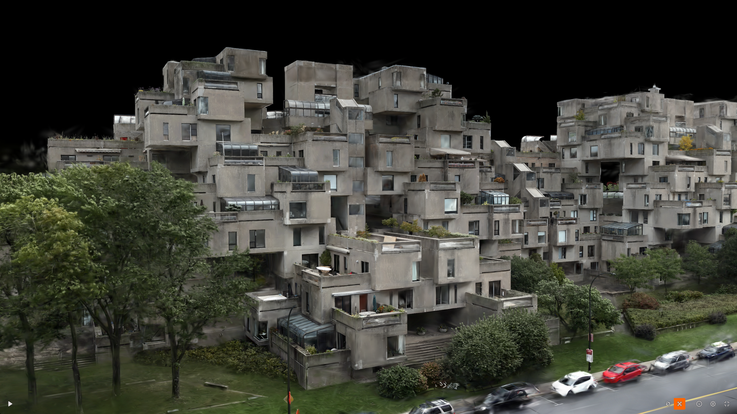
Habitat 67 3D Model
Where the next-gen methods in 3D raise the bar
This is an impressive model, but for new 3D methods such as Gaussian Splatting, a denser flight pattern with more images is needed for the best results. For buildings of this complexity in busy locations, that's been the limiting factor.
What's now practical: Automated Smart 3D Capture, from manual flying to model-driven capture
This abandoned church in a closed-down theme park was captured using automated 3D mapping - known as Smart 3D Capture, which is exclusive to DJI enterprise drones. The drone flew an initial overview, generated a 3D point cloud on the controller, then planned and flew its own optimised capture path around the structure fully autonomously.
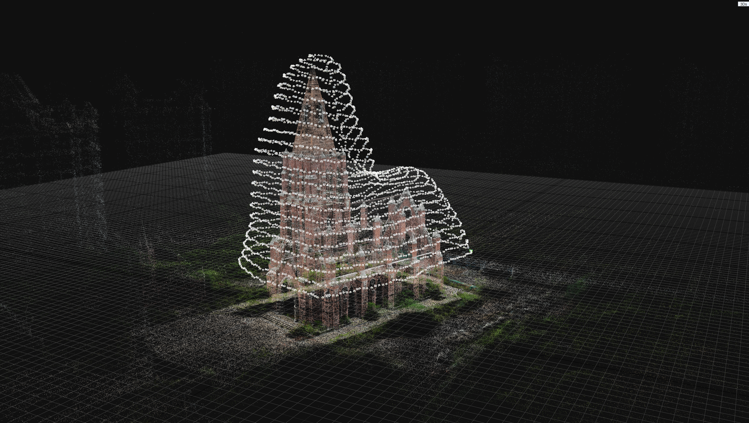
Point Cloud showing camera positions created using DJI 3D Smart Capture
Result: 2,798 images captured in around 30 minutes. Systematic coverage of every angle and elevation that no manual flight could match without a dramatically longer flight time.
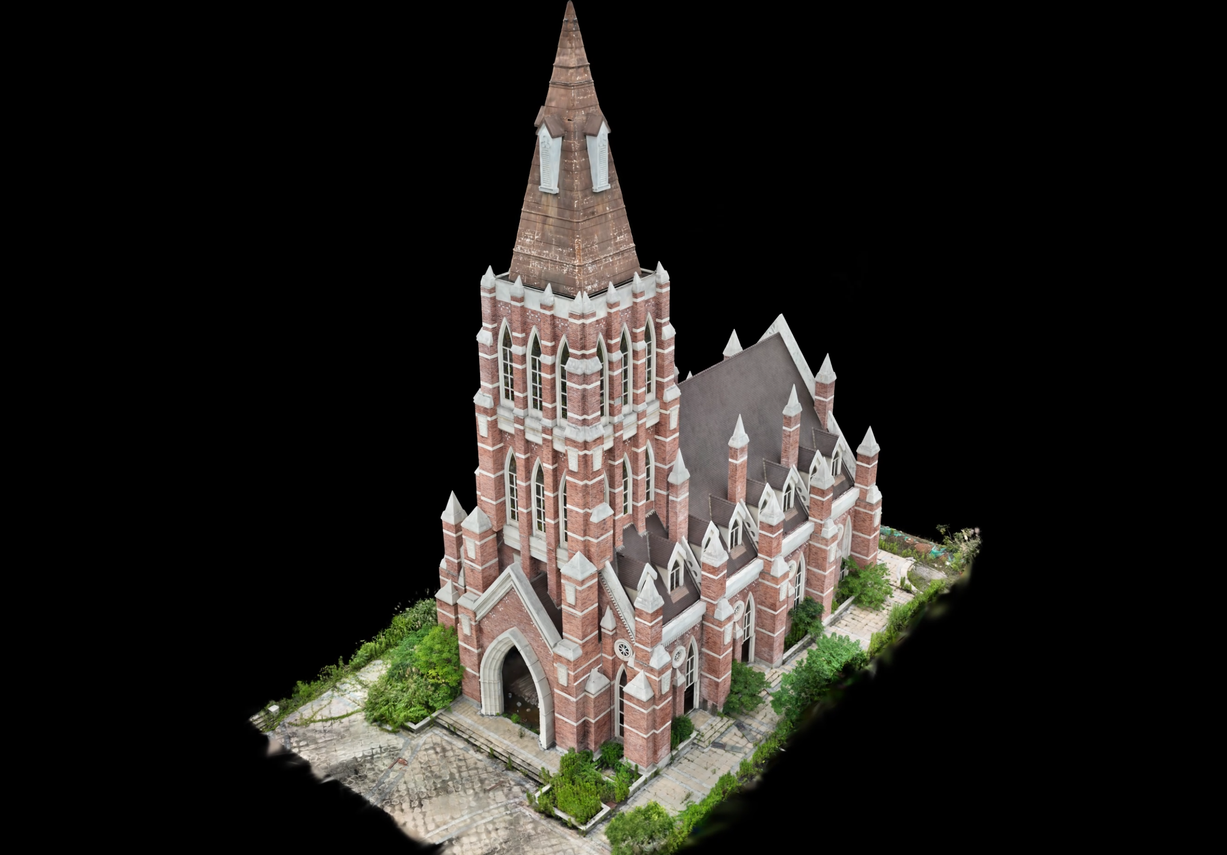
Gaussian Splat Model. Dataset credit - MipMap
View the full interactive 3D Gaussian Splat model here - https://superspl.at/view?id=eea8f548
This isn't about replacing flying skill or experience. It's about what produces much better 3D models: complete, overlapping coverage from calculated angles, with predictable flight paths that reduce risk.
The practical impact of the new CAA rules for 3D building documentation
The new UK regulations and purpose-built equipment arrive together. The DJI Matrice 4E is fully compliant with the new framework and built specifically for this kind of work with its advanced features such as Smart 3D Capture, RTK and laser rangefinder.
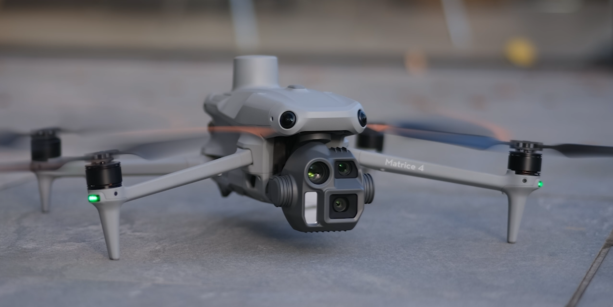
DJI Matrice 4E Enterprise Drone
The combination means very high quality and comprehensive 3D documentation becomes viable for:
University and hospital campuses with continuous public access
Urban buildings surrounded by pedestrian areas
Heritage sites that can't be closed to visitors
Commercial properties with staff or tenants
For standard photography and video, the regulatory change helps too, though sub-250g drones already offered more flexibility there. C1 Drones, up to 900 grams like the DJI Air 3S can now be flown directly over uninvolved people.
For 3D capture requiring enterprise equipment, this is where the real shift happens.
Questions about how this applies to your buildings or sites? Drop them in the comments or DM me.
If you’re planning a project in 2026 and curious how this would work for your building, let’s talk.
Habitat 67 dataset courtesy of REALIT, Leo Films and Drone Services Canada Inc.
Church dataset courtesy of MipMap.
3D models created by me.
I work at the intersection of architectural photography, 360° virtual tours, and next-generation 3D documentation technologies including Gaussian Splatting. Technical excellence and creative vision, backed by thorough project management.